Walks and Trails from Winterton
All of these walks and trails start and end at All Saints’ Church in Churchside, Winterton.
Location: Ordnance Survey grid reference SE 928186, or postcode DN15 9TU for Churchside (for satellite navigation purposes only).
Refreshments: Winterton has public houses, a coffee shop, minimarkets and takeaways — see Food and Drink in Winterton.
Parking: Roadside parking is not time-limited in West Street.
Toilets: Public convenience in Queen Street.
There is a detailed route description for each walk or ride, which can be downloaded and printed if needed (you will need Adobe Reader, as each file is in PDF format). The Ordnance Survey 1:25,000 Explorer Sheet 281, ‘Ancholme Valley’, covers all these walks and rides and much of the Lincolnshire Towers Trail.
Walk Around Winterton
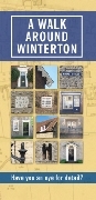
Winterton has a long history, some fascinating stories and several lovely stone buildings. This trail gives an introduction to the town. Total distance just over 2 miles, all paved except for a section via Simon’s Wood, which can be avoided.
There is also an online digital version of this walk at storymaps.arcgis.com.
Walk Around Winterton Parish

A walk or cycle ride about 6.1 miles long, all on tarmac road, lane or stone track. You will get a real feeling for the low-lying lands of the Ancholme Valley floor, and you never leave the parish of Winterton. All these lands were once farmed by those who lived in the medieval settlement of Winterton — land which gave rise to the ‘Winterton Riots’ in the 17th century, when the Ancholme Drainage scheme was implemented.
There is also an online digital version of this walk at storymaps.arcgis.com.
Ancholme Valley Trail
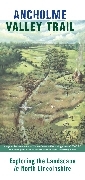
The River Ancholme runs north through the eastern part of Winterton parish to meet the Humber Estuary. To the east is the chalk scarp slope of the Lincolnshire Wolds, with the so-called ‘low villages’ — including Horkstow and Saxby All Saints. To the west rises the gentle dip slope of the Jurassic Limestone; settlements such as Winterton and Roxby lie up this slope, just above flood level. The valley was once a tidal inlet, and the lowest parts of the landscape result from flooding and repeated attempts at reclamation and drainage. Total distance around 15 miles, on tarmac road, lane, path or stone track.
There is also an online digital version of this trail at storymaps.arcgis.com.
Lincolnshire Towers Trail

Travel around the area of northern Lincolnshire and you will come across many fine examples of Anglo-Norman architecture, among them the so-called Lincolnshire Towers — a group of church towers unique to this part of the country, of which All Saints’, Winterton, is a fine example. This trail explores fourteen churches; at some, like Winterton, the tower is obvious, but at others only a fragment survives.
There is also an online digital version of this trail at storymaps.arcgis.com.
Download Route Details
- Walk Around WintertonRoute details (PDF)
- Walk Around Winterton ParishRoute details (PDF)
- Ancholme Valley TrailRoute details (PDF)
A downloadable route leaflet for the Lincolnshire Towers Trail was not available at the time of writing — please use the online digital version linked above.